About MapSphere Solutions LLP
Survey, mapping, and digital engineering specialists in India and Singapore, serving modern infrastructure.
The team behind the data
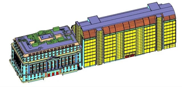
MapSphere Solutions — operating as MapSphere Solutions PTE LTD. and MapSphere Solutions LLP — is a globally focused geospatial and digital engineering company and specialized experts in BIM, LiDAR, and GIS mapping. We deliver next-generation BIM modeling, LiDAR technology, GIS mapping, drone surveying, CAD, remote sensing, and AI-integrated spatial solutions.
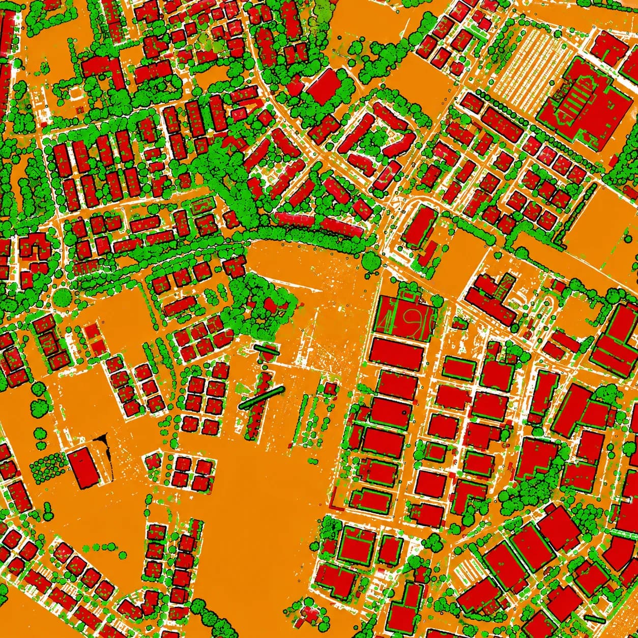
The complete spatial data lifecycle
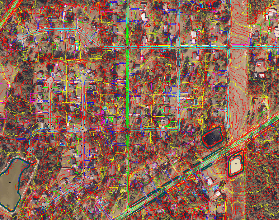
We combine advanced field instruments, intelligent data processing, and domain expertise to support infrastructure, transportation, industrial, utility, mining, and smart-city development projects with accurate, scalable digital deliverables.
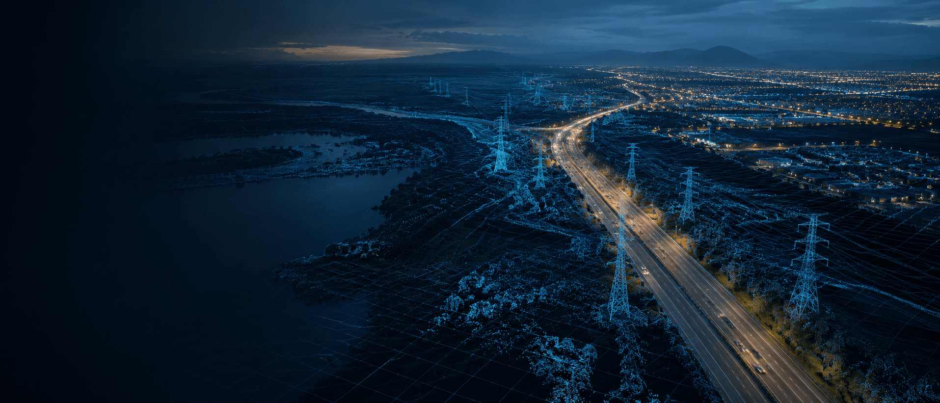
Precision spatial data, at scale
We exist to give organizations a clearer, measurable view of the ground — turning complex spatial reality into reliable, standards-compliant data that drives sharper infrastructure decisions.
One partner, full stack
From ground control and aerial capture to GIS, CAD, and BIM delivery — we cover the complete spatial data lifecycle under one accountable team.
A global view of our delivery network
Our India and Singapore production hubs deliver survey, processing, and digital-engineering work across continents.
Certified, registered, accountable
A legally registered dual-entity company operating to internationally recognized quality standards — with verifiable credentials behind every deliverable.
ISO 9001:2015
Quality Management System
Certificate No.
26EQQB94
Valid
25 May 2026 – 24 May 2029
Issued by
Assurance Quality Certification LLC
EGAC Accredited · IAF Member (IAF Code 34)
Scope — Geospatial surveying, GIS mapping & analysis, remote sensing, engineering survey, DGPS & total station survey, topographic & utility survey, photogrammetry, 3D mapping, CAD drafting, and BIM modeling (Revit / ReCap).
View certificateStatutory registrations
Registered in Singapore & India · Incorporated Jan 2026
UENSingapore · PTE LTD.
202604398C
LLPINIndia · LLP
ACU-7121
GSTINIndia · LLP
33ACGFM3463P1ZT
Visionary leadership, specialized expertise
A synergy of strategic leadership and deep technical depth across geoscience, hydrogeology, and geospatial AI — driving precision and innovation across every project.
Founder
Founder
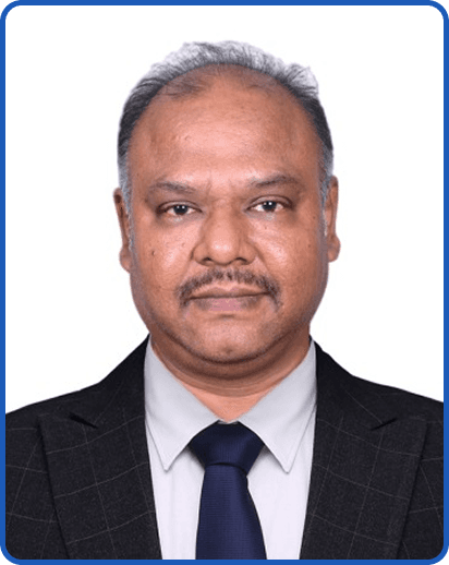
Mr. Raja Thiyagarajan
An MBA graduate with a robust background in core business and IT strategy. He has served leading global companies including HCL, TCS, Atos, Hewlett Packard, Genpact, and TTEC, bringing expertise in enterprise systems, digital operations, and organizational performance.
Expert Team
Expert Team
Dr. S. Senthilkumar
PhD in Geology · Hydrogeologist
Specializing in groundwater hydrology, hydrogeochemistry, and coastal aquifer systems. He applies geochemical modeling, contamination analysis, and Remote Sensing & GIS to deliver actionable insights for groundwater quality and environmental risk. His work spans major research programs, government projects, and advanced bathymetric surveys.
Dr. S. Gopinath
PhD in Earth Sciences · Applied Geoscientist
Focused on coastal hydrogeology, groundwater salinization, and integrated environmental assessment. He combines hydrochemical, geophysical, isotopic, and Remote Sensing & GIS methods with advanced modeling to produce precise, data-driven groundwater solutions. His portfolio includes international research roles, coastal aquifer projects, and high-impact publications.
Dr. P. Ramamoorthy
PhD in Hydrogeochemistry · Professor of Civil Engineering
Professor at Mailam Engineering College with over 12 years of academic experience and 2 years of industry expertise. With a Ph.D. in Hydrogeochemistry and 25 research publications, he actively contributes as a reviewer for reputed international journals. He has presented at national and international conferences and organized numerous academic programs.
K. Sanjay
AI & Machine Learning Engineer · Geospatial Intelligence
Specializing in geospatial intelligence and intelligent automation. He develops scalable, location-aware solutions that combine GIS, remote sensing, and deep learning to solve environmental and infrastructure challenges. With a strong focus on ethical innovation, he is currently building next-generation geospatial AI tools aimed at enabling smarter, more sustainable decision-making.
B. Sunil
B.Tech – AIDS · AI & Machine Learning
With a strong foundation in Artificial Intelligence, Machine Learning, and Data Science, he supports the development of intelligent workflows for Photogrammetry, LiDAR, and GIS operations. Sunil plays a key role in bridging traditional geomatics with next-generation data intelligence.