BIM Modeling & Mapping
Scan-to-BIM, coordination, clash detection, and as-built models.
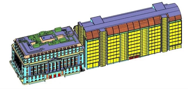
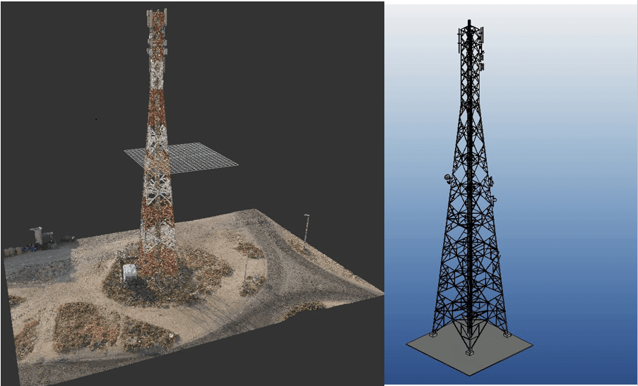
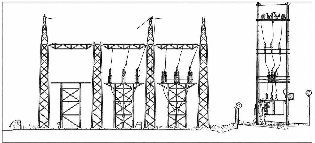
MapSphere delivers internationally recognized BIM modeling — Scan to BIM, architectural and structural modeling, MEP/FP/FA coordination, clash detection, shop drawings, and 4D/5D BIM.
We turn point clouds and design inputs into coordinated, clash-free models for construction, transportation, utility, and smart-city projects.
Key deliverables
Scope of work
- Scan to BIM
- Architectural BIM modeling
- Structural BIM modeling
- MEP / FP / FA modeling
- BIM coordination
- Clash detection
- Shop drawings
- As-built models
- 4D & 5D BIM
What you receive
- BIM models
- Revit models
- LOD 100 – 500
- Coordination models
- Clash reports
- Shop drawings
- As-built models
Sample outputs


Where it’s used
How we deliver it
Project Scope
Understand site, objective, deliverables, timeline, and accuracy needs.
Survey Planning
Select the right method — UAV, DGPS, Total Station, LiDAR, GPR, Bathymetry, or hybrid.
Data Capture
Collect field, aerial, scan, image, and control data with approved instruments and trained teams.
Processing & Modeling
Convert raw data into GIS, CAD, BIM, orthophotos, point clouds, DTM/DSM/DEM, and maps.
Quality Validation
Validate accuracy, topology, alignment, coordinate system, completeness, and standards.
Final Delivery
Deliver maps, drawings, reports, spatial databases, models, and decision-ready outputs.

BIM Modeling — common questions
01What is Scan-to-BIM and how accurate is it?
Scan-to-BIM converts a registered laser-scan point cloud — millimetre-level data, ±1–2 mm at 20 m on our Trimble X9 — into an intelligent, parametric Revit model. We model to your specified LOD (100–500) and validate geometry against the source cloud so the as-built reflects field reality, not assumptions.
02Which BIM deliverable formats do you provide?
We deliver native Revit (.rvt) models, IFC for open exchange, coordination (federated) models, NWD/NWC for clash review, clash-detection reports, and 2D shop drawings. Outputs follow the ISO 19650 information-management framework and your project's BIM Execution Plan.
03Can you model MEP, structural, and architectural together?
Yes. We produce coordinated architectural, structural, and MEP/FP/FA models in a single federated environment, run clash detection between disciplines, and issue prioritized clash reports so conflicts are resolved before they reach site.
04What LOD should I ask for?
It depends on the use case: LOD 200–300 suits design coordination, LOD 350–400 suits fabrication and construction, and LOD 500 is reserved for verified as-built/facility-management models. We'll recommend the right level for your scope during scoping.
Start your BIM Modeling project
Share your site and objectives — we’ll scope the right approach and timeline.