
Point Cloud & Ortho Image Processing
Classified 3D point clouds and distortion-free, georeferenced orthophotos — decision-ready for CAD, BIM, GIS, and measurement.
MapSphere turns raw geospatial data into ready-to-use products — processing massive LiDAR and photogrammetric point clouds (registration, denoising, classification, feature extraction) and correcting aerial and satellite imagery into accurate, georeferenced orthophotos and base maps.
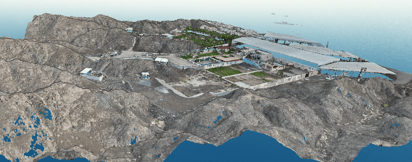
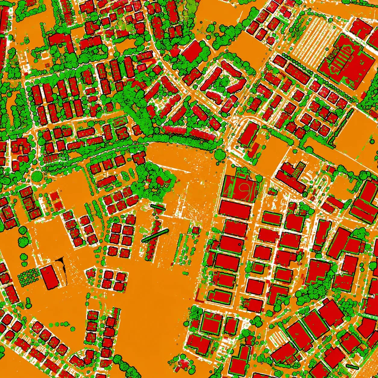
We clean, classify, and structure raw point clouds into ground, vegetation, building, and asset layers that feed DTM/DSM, CAD, BIM, and GIS deliverables.
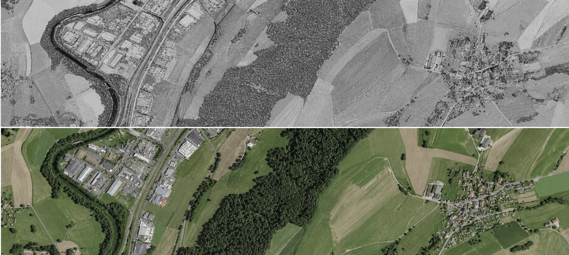
Our orthorectification, mosaicking, and georeferencing pipelines remove tilt, terrain, and perspective distortion — delivering GIS-ready imagery and base maps at consistent accuracy across large project areas.
Key deliverables
Scope of work
- Point cloud registration
- Denoising & filtering
- Ground & feature classification
- Feature & asset extraction
- DTM / DSM generation
- Cross-section & profile extraction
- Orthorectification
- Mosaic creation
- Georeferencing
- Color balancing
- Satellite & aerial image processing
What you receive
- Classified point clouds
- LAS / LAZ
- DTM / DSM
- Extracted features
- Cross-sections
- GeoTIFF orthomosaics
- Map tiles
- GIS-ready base maps
Sample outputs
Where it’s used
How we deliver it
Project Scope
Understand site, objective, deliverables, timeline, and accuracy needs.
Survey Planning
Select the right method — UAV, DGPS, Total Station, LiDAR, GPR, Bathymetry, or hybrid.
Data Capture
Collect field, aerial, scan, image, and control data with approved instruments and trained teams.
Processing & Modeling
Convert raw data into GIS, CAD, BIM, orthophotos, point clouds, DTM/DSM/DEM, and maps.
Quality Validation
Validate accuracy, topology, alignment, coordinate system, completeness, and standards.
Final Delivery
Deliver maps, drawings, reports, spatial databases, models, and decision-ready outputs.
Point Cloud & Ortho — common questions
01What does point-cloud processing involve?
Registration of multiple scans into one coordinate system, denoising and filtering, ground/feature classification, and extraction of features, cross-sections, and surfaces — producing clean, decision-ready data from raw billions of returns.
02Can you classify clouds from other vendors' scanners?
Yes. We process LAS/LAZ/E57 from most ALS, MLS, TLS, and photogrammetric sources, re-classify to ASPRS standards, and deliver consistent ground, vegetation, building, and asset layers.
03What can you extract from a processed cloud?
Bare-earth DTM and DSM surfaces, breaklines, cross-sections and profiles, and discrete assets (poles, signs, kerbs, structures) ready for CAD, BIM, or GIS.
04What accuracy can I expect from your orthophotos?
Drone orthomosaics are produced at 1–5 cm GSD with RTK/PPK control, georeferenced and orthorectified so measurements are distortion-free and GIS-ready.
05What's the difference between an orthophoto and a raw aerial image?
A raw image contains tilt, perspective, and terrain distortion. An orthophoto is corrected so every pixel sits at its true ground position, letting you measure distances and areas directly on the image.
06Can you mosaic and color-balance large project areas?
Yes — we mosaic hundreds of frames into seamless, color-balanced GeoTIFFs and map tiles at consistent accuracy across the whole site.
Start your Point Cloud & Ortho project
Share your site and objectives — we’ll scope the right approach and timeline.