LiDAR Technology — ALS / MLS / TLS
High-density 3D point clouds from airborne, mobile, drone, and terrestrial platforms.
MapSphere captures and processes LiDAR data across airborne (ALS), mobile (MLS), drone, and terrestrial (TLS) platforms to deliver high-density point clouds, terrain models, and 3D asset datasets.
From corridor and urban mapping to asset extraction and digital-twin creation, our point-cloud pipelines turn billions of laser returns into accurate, classified, decision-ready spatial data.
Key deliverables
Scope of work
- Highway & Road Corridor Mapping
- Railway & Metro Corridor Survey
- Smart City Mapping Projects
- Airport Runway & Taxiway Survey
- Industrial Plant & Refinery Mapping
- Utility & Power Line Asset Mapping
- Bridge & Tunnel Inspection
- Road Inventory & Asset Management
- Port & Harbor Mapping
What you receive
- LAS / LAZ files
- E57 files
- Classified point clouds
- DTM / DSM / DEM
- 3D asset datasets
- 3D Corridor maps
- CAD / GIS layers
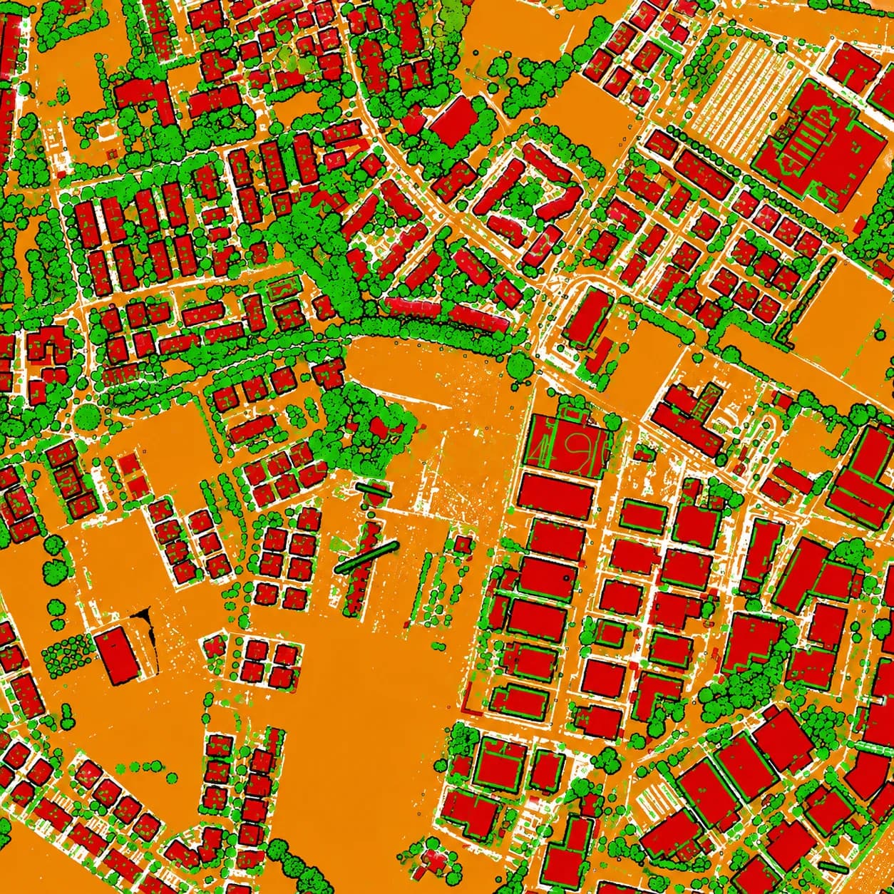
Sample outputs


Where it’s used
How we deliver it
Project Scope
Understand site, objective, deliverables, timeline, and accuracy needs.
Survey Planning
Select the right method — UAV, DGPS, Total Station, LiDAR, GPR, Bathymetry, or hybrid.
Data Capture
Collect field, aerial, scan, image, and control data with approved instruments and trained teams.
Processing & Modeling
Convert raw data into GIS, CAD, BIM, orthophotos, point clouds, DTM/DSM/DEM, and maps.
Quality Validation
Validate accuracy, topology, alignment, coordinate system, completeness, and standards.
Final Delivery
Deliver maps, drawings, reports, spatial databases, models, and decision-ready outputs.

LiDAR Technology — common questions
01What's the difference between ALS, MLS, and TLS?
Airborne LiDAR (ALS) covers large areas at 4–50 pts/m² with ±5–15 cm accuracy; Mobile LiDAR (MLS) maps corridors at 500–5000 pts/m² and ±1–3 cm; Terrestrial (TLS) captures static scenes at millimetre level (±2–6 mm). We select the platform to match area, accuracy, and access.
02What point-cloud formats do you deliver?
LAS/LAZ and E57 classified point clouds, plus derived DTM/DSM/DEM, 3D asset datasets, and CAD/GIS layers. Classification follows ASPRS conventions.
03How dense is your typical point cloud?
Density depends on the platform — from 100–1000+ pts/m² for UAV LiDAR up to 1000–10000+ pts/m² for terrestrial scanning. We set the target density during scoping based on the smallest feature you need to resolve.
Start your LiDAR Technology project
Share your site and objectives — we’ll scope the right approach and timeline.