Your world,mappedwith precision
Survey-grade BIM, CAD, LiDAR, GIS and drone solutions — turning field data into decision-ready spatial intelligence for infrastructure and industry.
Trusted across government, infrastructure & industry
Geospatial engineering,
built for modern infrastructure
Operating as MapSphere Solutions PTE LTD. and MapSphere Solutions LLP, we translate complex ground reality into accurate, standards-compliant spatial data.
Field to digital intelligence, traced end to end
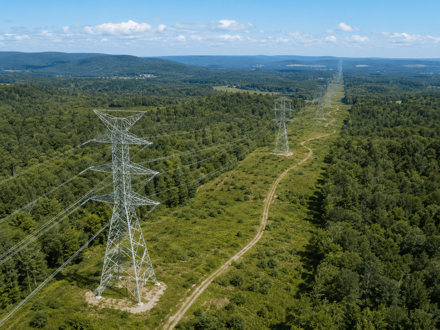
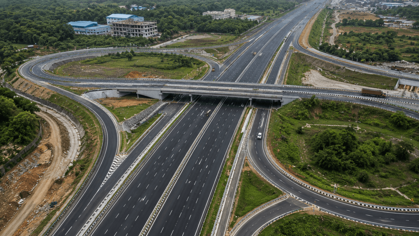
Field & aerial data acquisition

UAV drones, LiDAR, DGPS, total stations, GPR, and bathymetric sensors capture the ground exactly as it is — across corridors, sites, plants, and water bodies. Ground control and calibrated instruments anchor every dataset to survey-grade accuracy.
Point clouds into clean, classified data

Raw scans, imagery, and LiDAR returns are registered, classified, and refined into accurate terrain models, orthophotos, and feature layers. Multi-stage QA validates topology, alignment, and coordinate systems before anything moves forward.
GIS, CAD & BIM deliverables

Clean data becomes decision-ready output — multi-layer GIS, as-built BIM, CAD drawings, DTM/DSM/DEM, and 3D models built to international standards and your project's exact specification and formats.
Decision-ready spatial intelligence

Final maps, models, drawings, and spatial databases are delivered with documentation and ongoing support — giving infrastructure, utility, mining, and smart-city teams a clear, measurable view of the ground.
Deliverables, not just data
Every capture we fly and scan comes back as _
Real capability, real outputs
LiDAR Classification
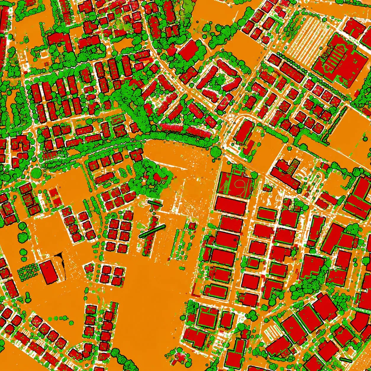
GIS Feature Extraction

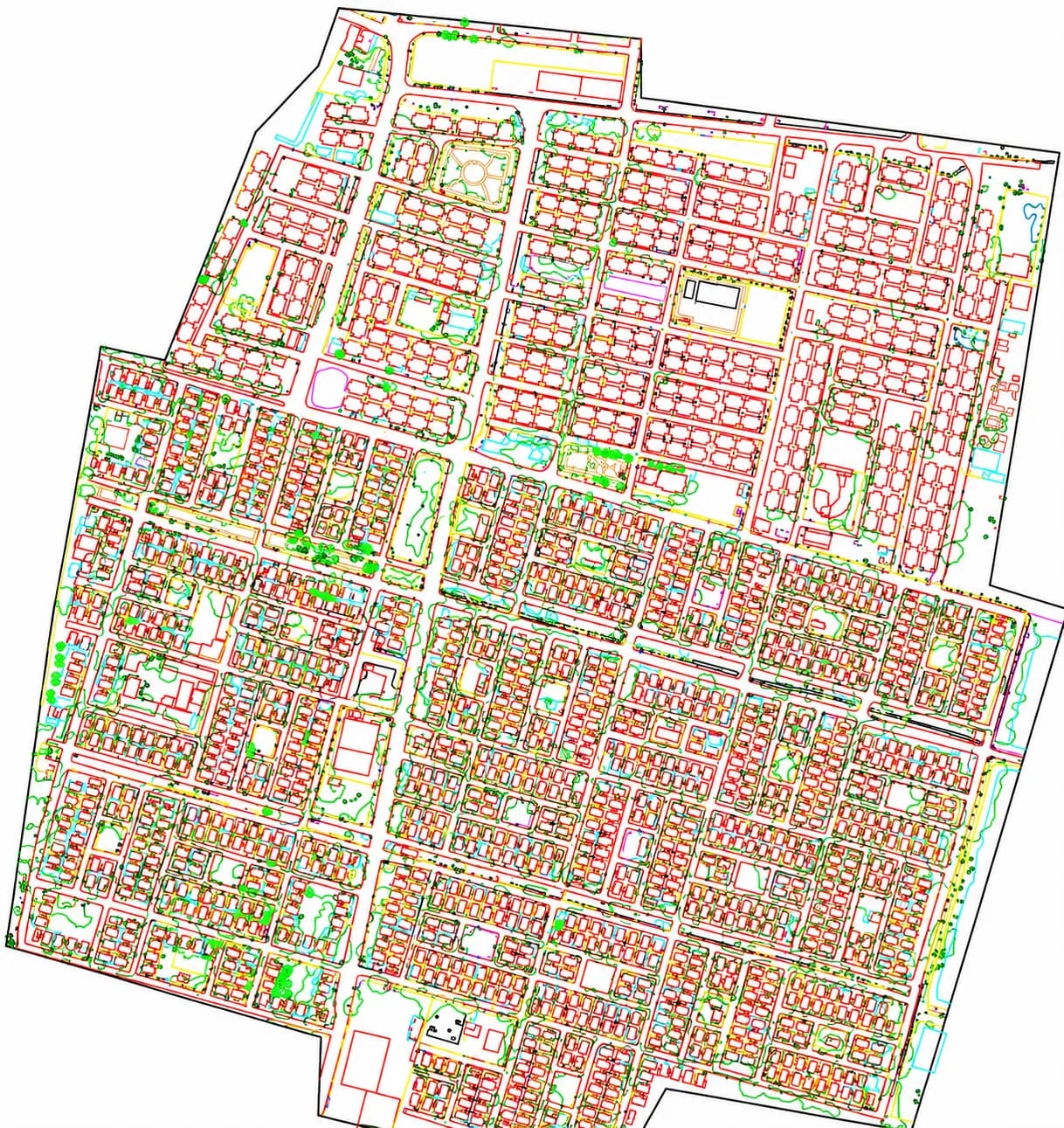
CAD Mapping Output
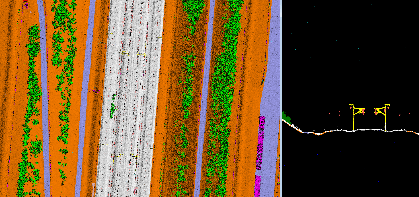
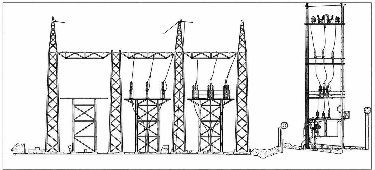
Railway LiDAR Classification

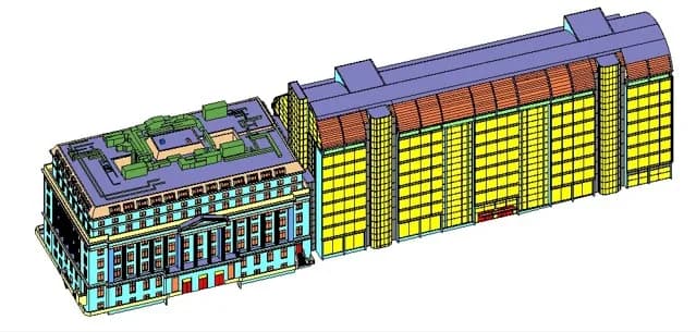
Structural BIM Model

Corridor Classification
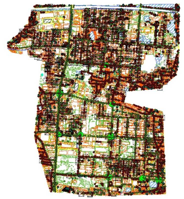
Cadastral GIS Mapping

Utility Network Mapping

Road Corridor Orthophoto

Photogrammetry Mesh
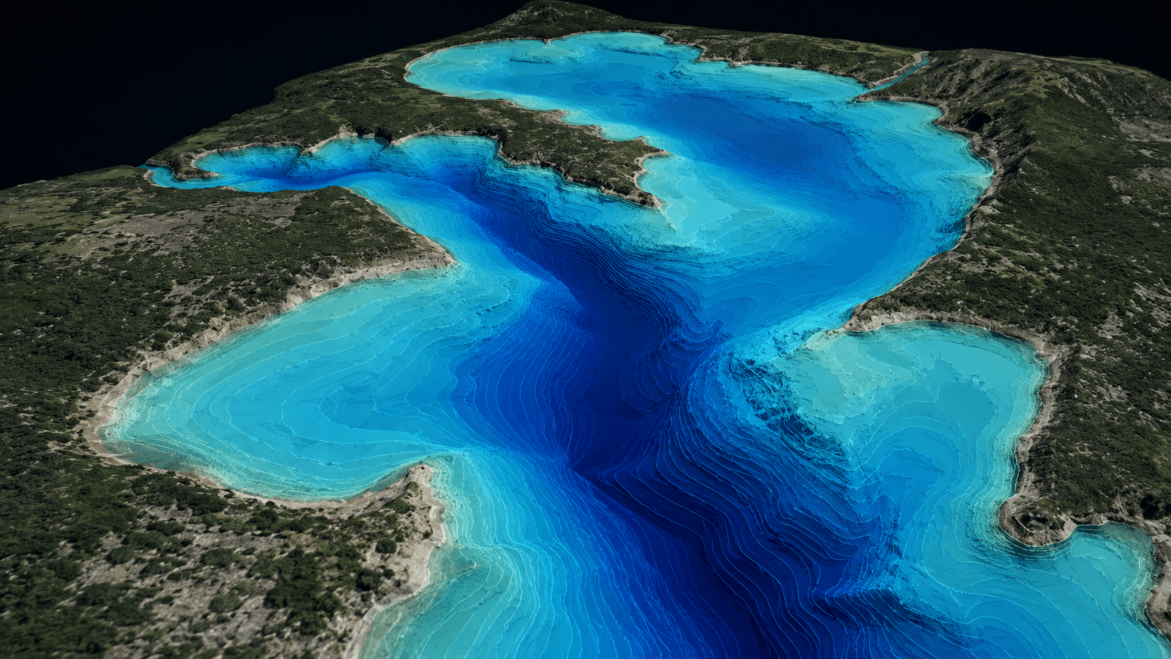
Bathymetric Survey
LiDAR Classification
GIS Feature Extraction
CAD Mapping Output
Railway LiDAR Classification
Structural BIM Model
Corridor Classification
Cadastral GIS Mapping
Utility Network Mapping
Road Corridor Orthophoto
Photogrammetry Mesh
Bathymetric Survey
Industries


Our instrument stack
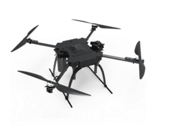
UAV Survey Drone
Compliant aerial mapping and survey across regulated airspace and project sites.
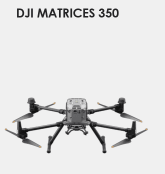
DJI Matrice 350
Heavy-lift RTK platform carrying DJI L2 LiDAR and mapping payloads for terrain, corridor, and asset capture.
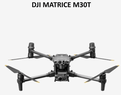
DJI Matrice M30T
Compact thermal + visual platform for inspection, solar, and rapid mapping.
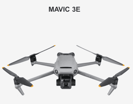
Mavic 3E
Lightweight mapping drone for rapid, high-detail site capture.

Total Station
Precise engineering layout, topographic, and alignment survey.
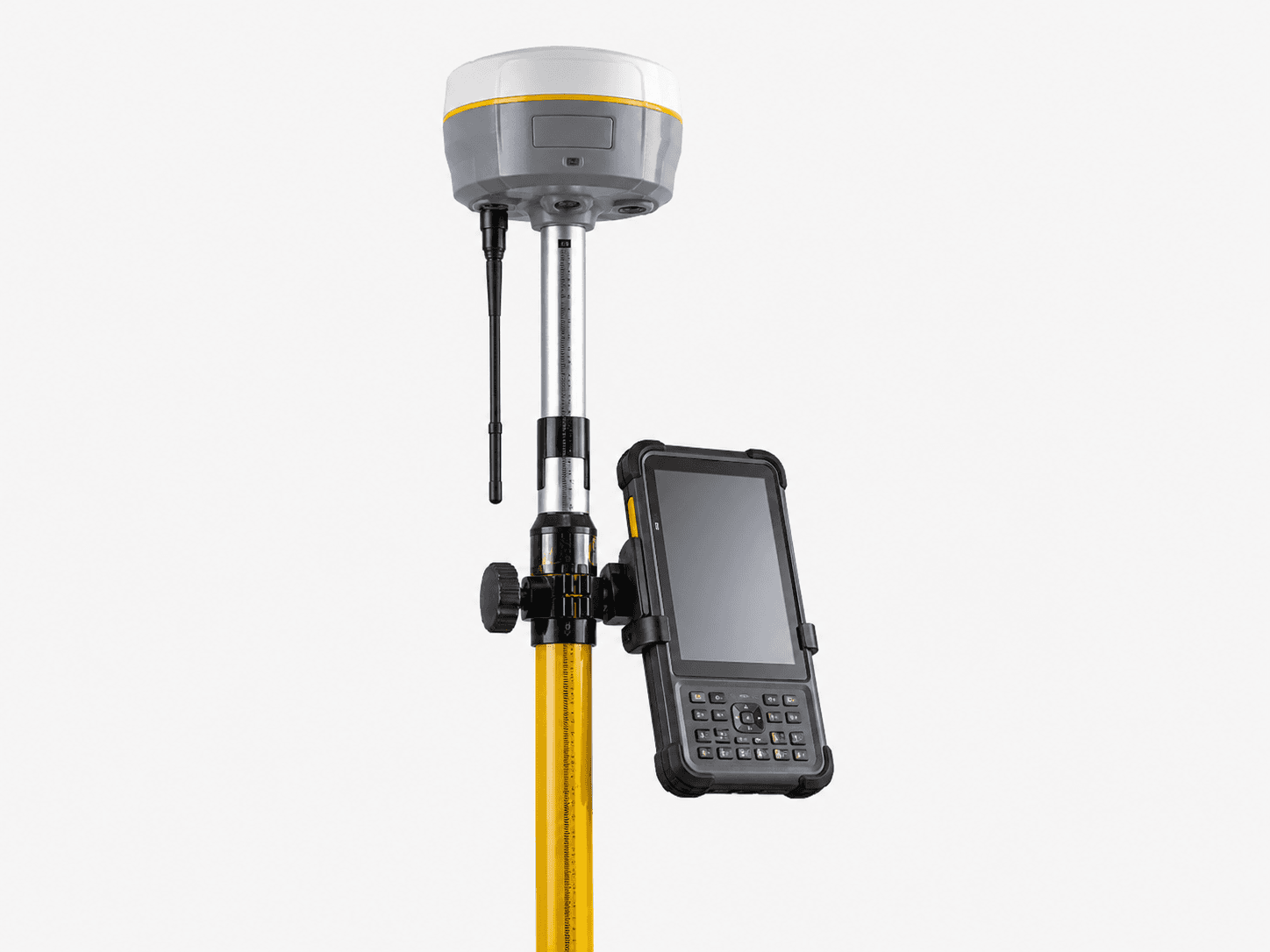
DGPS — SP85 / Trimble R980
Survey-grade RTK positioning and control-point establishment.
Project-ready deliverables


Two production hubs, delivery worldwide
Our offices in India and Singapore run survey, processing, and digital-engineering production — serving infrastructure, utility, and smart-city projects across continents.

Built for accuracy. Ready for scale.
End-to-end workflow
From ground control to final delivery, handled in one accountable pipeline.
Survey-grade accuracy
Calibrated instruments, ground control, and validation at every stage.
Quality-assured outputs
Multi-stage QA before anything reaches your inbox.
Advanced instruments
UAV drones, LiDAR, GPR, bathymetry, and laser scanning in-house.
GIS · LiDAR · BIM · CAD
Deep expertise across the full geospatial and digital-engineering stack.
International standards
India-based teams delivering to global specification and formats.
Need survey-grade maps, models, or spatial data?
Talk to MapSphere Solutions about your site, corridor, asset, infrastructure, or development project.