Water Pipeline & Drainage Corridors
Terrain, contour, and corridor survey for pipelines, drainage, and water infrastructure.
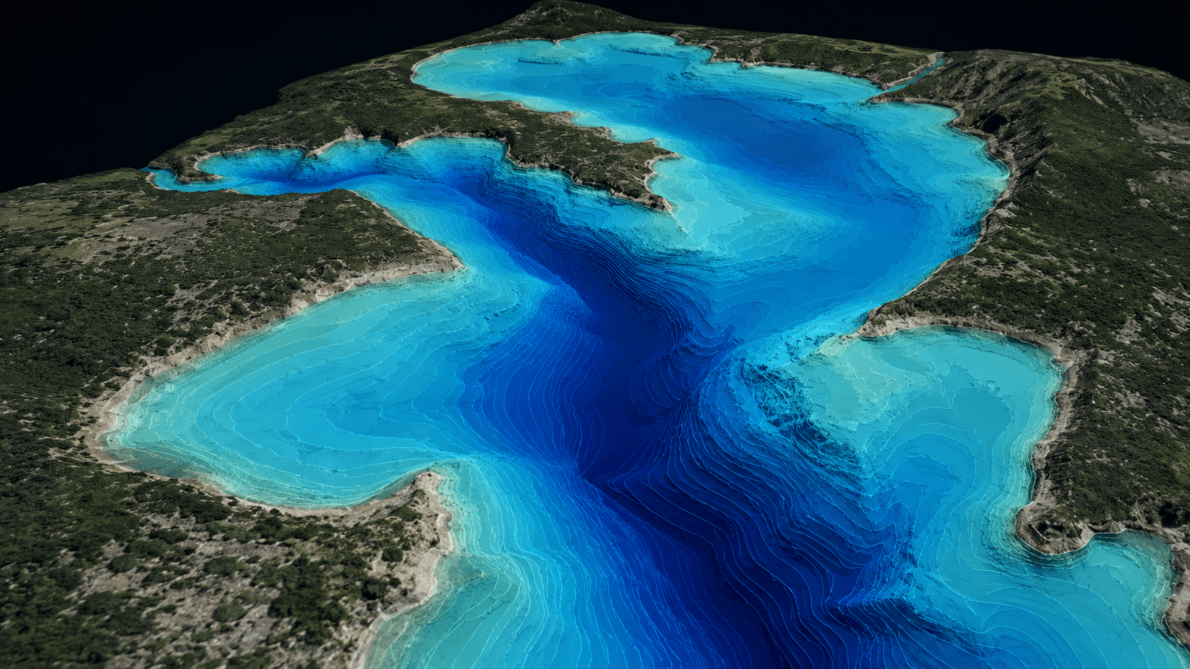
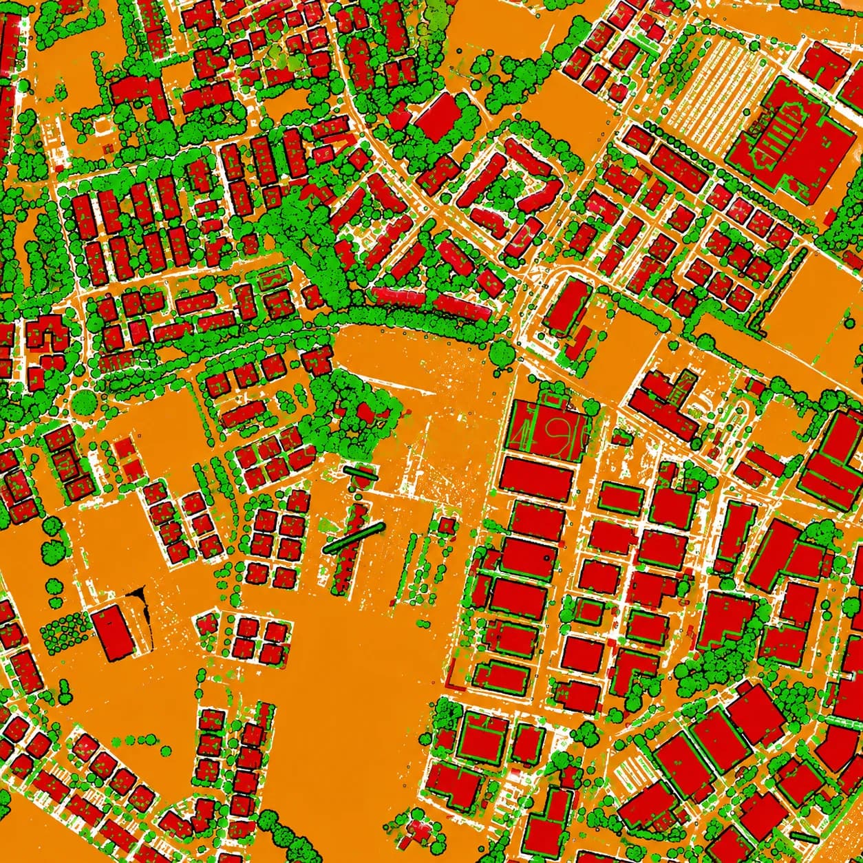
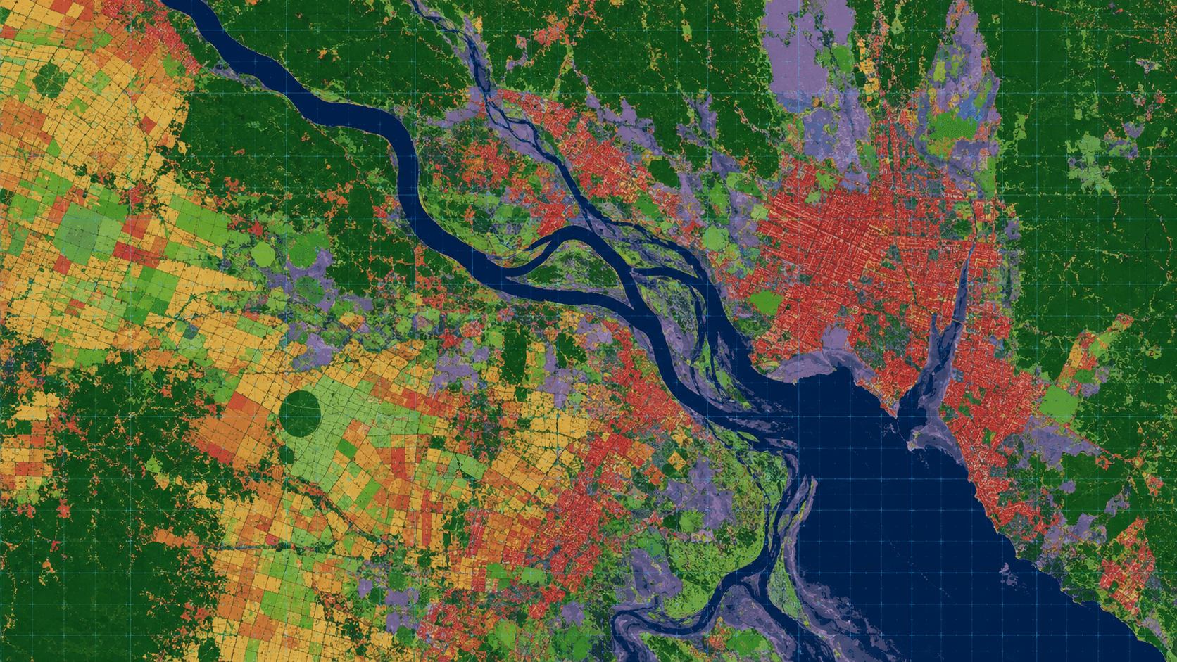
Water and drainage infrastructure follows the terrain, so accurate surfaces and corridors are essential. MapSphere delivers DTM/DEM, contours, and corridor mapping for pipelines, drains, and water networks, combining LiDAR, bathymetry, and remote sensing.
Our data underpins routing, drainage design, and flood modeling.
Relevant services
Use cases
What this sector demands
Gradient-sensitive design
Drainage and gravity mains need accurate, validated vertical surfaces.
Mixed land and water
Corridors cross channels and water bodies, needing combined topo-bathy capture.
Catchment-scale context
Remote sensing situates corridors within their wider catchment and land-cover context.
What you receive
- DTM / DEM
- Contour maps
- Corridor layers
- Hydrological reports
How we deliver it
We capture corridors with LiDAR and survey, add bathymetry at crossings, and derive DTM/DEM, contours, and corridor layers with hydrological reporting.
Deliverables include DTM/DEM, contour maps, corridor layers, and hydrological reports.
Services we apply here
Water Pipeline & Drainage Corridors — common questions
01Why is vertical accuracy so important here?
Gravity drainage and water mains depend on gradient. We deliver ground-controlled, validated DTM/DEM so design grades are based on real terrain.
02Can you survey across rivers and channels?
Yes. We combine topographic/LiDAR capture with bathymetry at crossings to produce continuous corridor surfaces over land and water.
03Do you support flood modeling?
We deliver terrain, contours, and corridor data, plus remote-sensing land-cover context, suitable for hydrological and flood modeling.
Planning a water pipeline & drainage corridors project?
Tell us about your site and objectives — we'll scope the right survey approach, accuracy, and deliverables.