PLS CAD — Transmission Line Design
PLS-CADD transmission line modeling, sag-tension, and tower spotting.
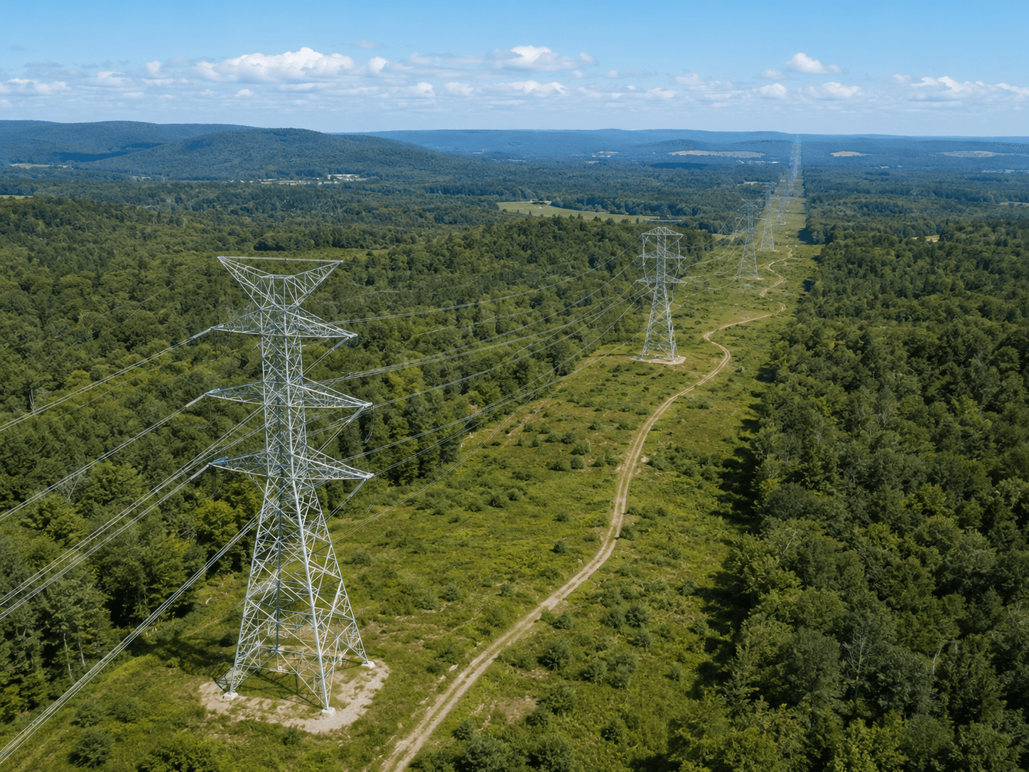
MapSphere delivers PLS-CADD transmission line design and modeling — terrain integration, sag-tension analysis, tower spotting, and clearance verification for power and transmission corridors.
From LiDAR-derived terrain to optimized tower placement, our PLS-CADD workflows support reliable, standards-compliant transmission line design, clearance checks, and as-built line modeling.
Key deliverables
Scope of work
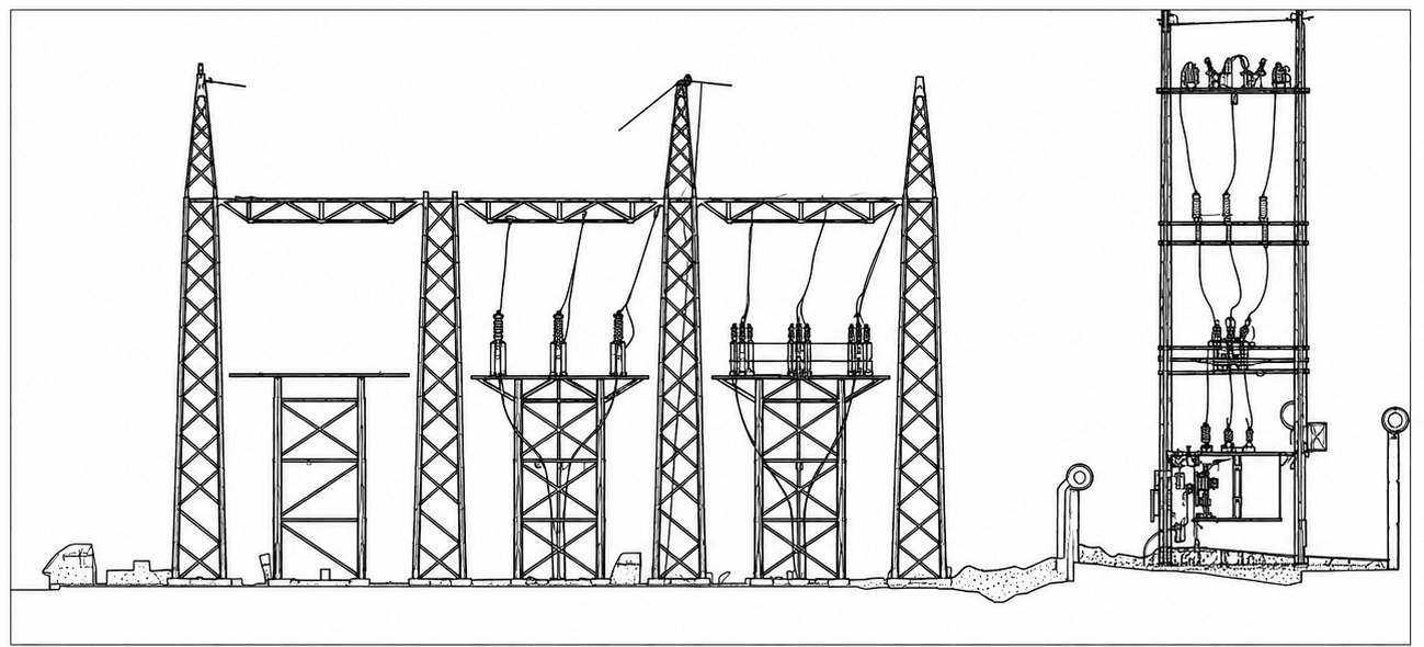
- PLS-CADD line design & modeling
- Sag-tension analysis
- Tower spotting & optimization
- Clearance & ground checks
- LiDAR terrain integration
- As-built line modeling
What you receive
- PLS-CADD models
- Sag-tension reports
- Tower schedules
- Clearance reports
- Plan & profile drawings
Sample outputs


Where it’s used
How we deliver it
Project Scope
Understand site, objective, deliverables, timeline, and accuracy needs.
Survey Planning
Select the right method — UAV, DGPS, Total Station, LiDAR, GPR, Bathymetry, or hybrid.
Data Capture
Collect field, aerial, scan, image, and control data with approved instruments and trained teams.
Processing & Modeling
Convert raw data into GIS, CAD, BIM, orthophotos, point clouds, DTM/DSM/DEM, and maps.
Quality Validation
Validate accuracy, topology, alignment, coordinate system, completeness, and standards.
Final Delivery
Deliver maps, drawings, reports, spatial databases, models, and decision-ready outputs.
PLS CAD — common questions
01What does a PLS-CADD transmission line deliverable include?
A typical package includes the PLS-CADD model, sag-tension analysis, tower spotting and optimization, clearance/ground-check reports, and plan-and-profile drawings — built on LiDAR-derived terrain for real-world accuracy.
02How does LiDAR feed PLS-CADD design?
Classified LiDAR gives a precise bare-earth terrain plus existing conductors, structures, and vegetation. We import that into PLS-CADD so tower placement, clearances, and sag-tension are calculated against the actual corridor rather than coarse contours.
03Can you verify clearances on an existing line?
Yes — using as-built LiDAR we model the existing line, check statutory ground and crossing clearances, and flag encroachments or hot-spots for remediation.
Start your PLS CAD project
Share your site and objectives — we’ll scope the right approach and timeline.