Utilities & Powerlines
End-to-end mapping of electrical, water, gas, and telecom networks for resilient assets.
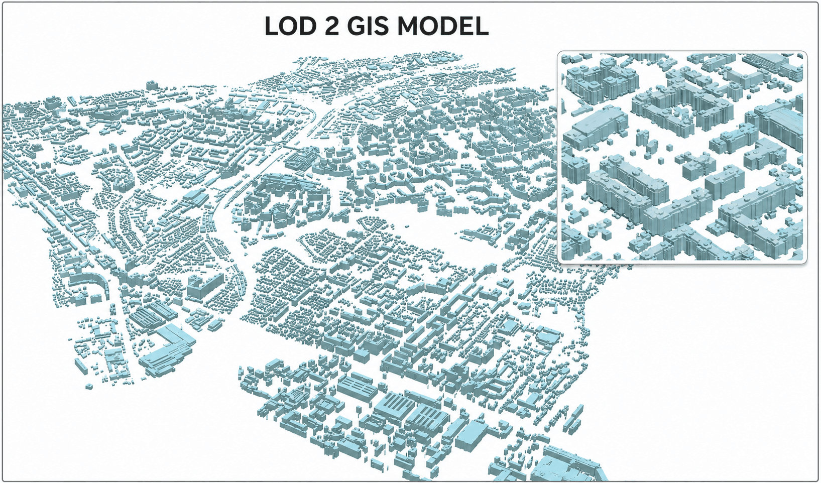
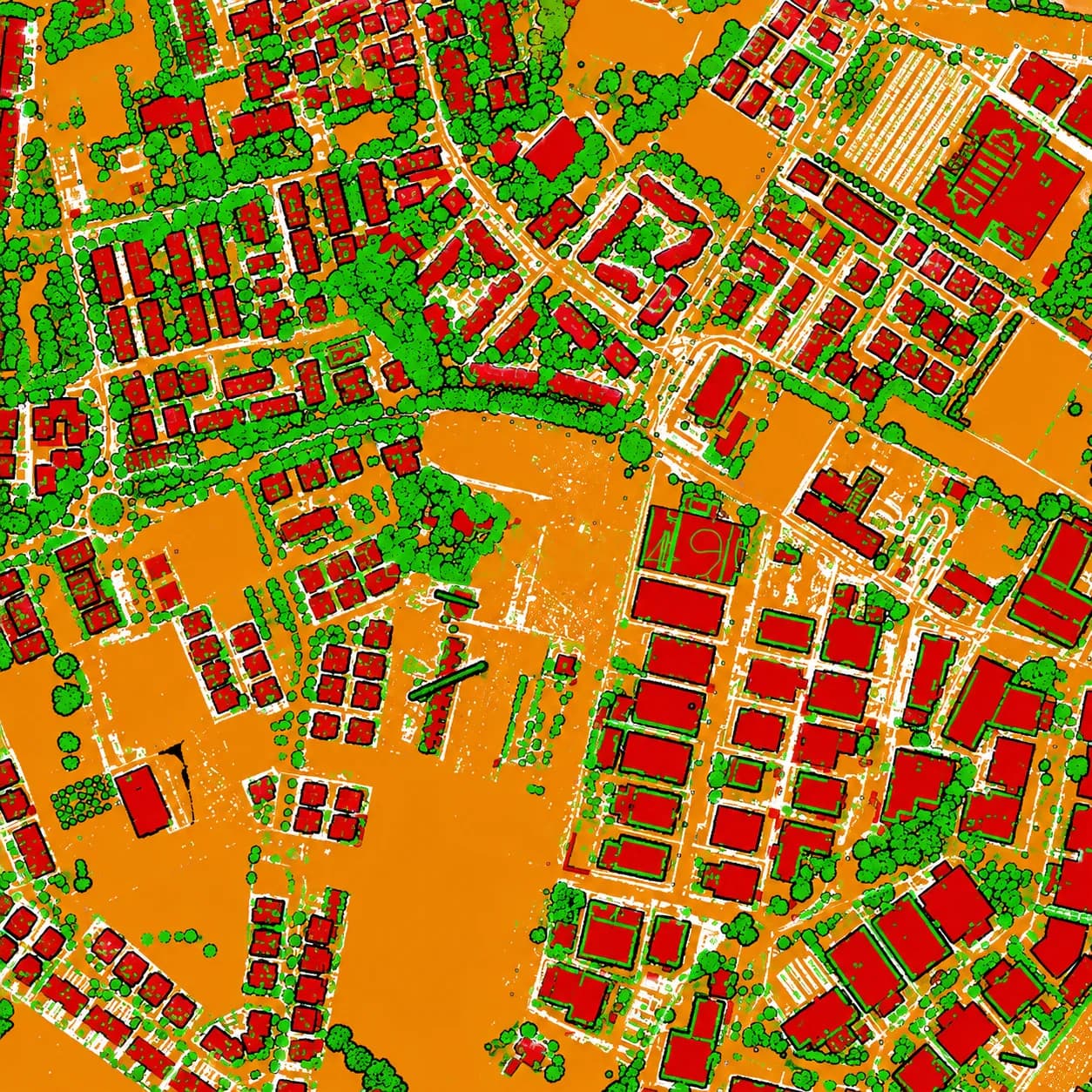
Utility networks are only as manageable as their spatial records. MapSphere maps electrical, water, gas, and telecom networks end-to-end — combining mobile LiDAR corridor capture, GPR for buried services, and attribute-rich GIS.
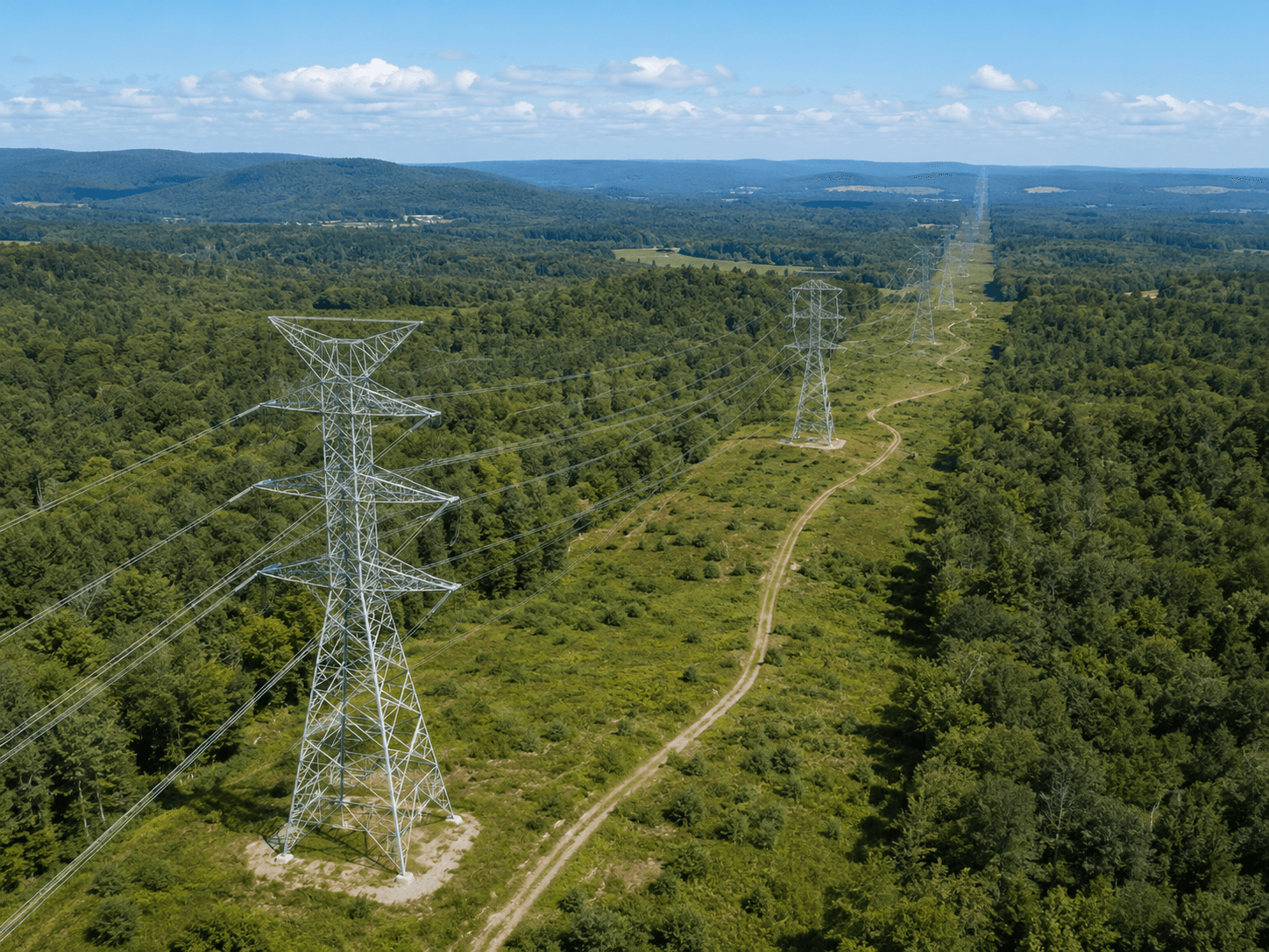
For transmission, we extend into PLS-CADD line design, clearance verification, and as-built line modeling.
Relevant services
Use cases
What this sector demands
Above and below ground
Networks span overhead lines and buried services. LiDAR captures the corridor; GPR detects what's underground.
Attribute completeness
An asset map is only useful with reliable attributes — we capture and validate them into a structured geodatabase.
Clearance & vegetation risk
Transmission corridors need accurate conductor, structure, and vegetation data for clearance and encroachment analysis.
What you receive
- Utility GIS layers
- Network diagrams
- Asset attributes
- CAD drawings
How we deliver it
We capture corridors with mobile/UAV LiDAR, detect buried utilities with GPR, and build attribute-rich GIS networks; for transmission we model the line in PLS-CADD and verify clearances.
Deliverables include utility GIS layers, network diagrams, asset attributes, CAD drawings, and PLS-CADD models and reports.
Services we apply here
Utilities & Powerlines — common questions
01Can you map both overhead and underground utilities?
Yes. Mobile and UAV LiDAR capture overhead lines and corridor features, while GPR locates buried pipes and cables — combined into one attribute-rich GIS network.
02Do you support transmission line design?
We model transmission lines in PLS-CADD from LiDAR terrain, run sag-tension and tower spotting, and verify statutory clearances against the captured corridor.
03What attributes do you capture for assets?
We capture and validate the attribute schema you need — asset type, condition, identifiers, and connectivity — into a topology-validated geodatabase.
Planning a utilities & powerlines project?
Tell us about your site and objectives — we'll scope the right survey approach, accuracy, and deliverables.